Search and Rescue Satellite Aided Tracking (SARSAT)
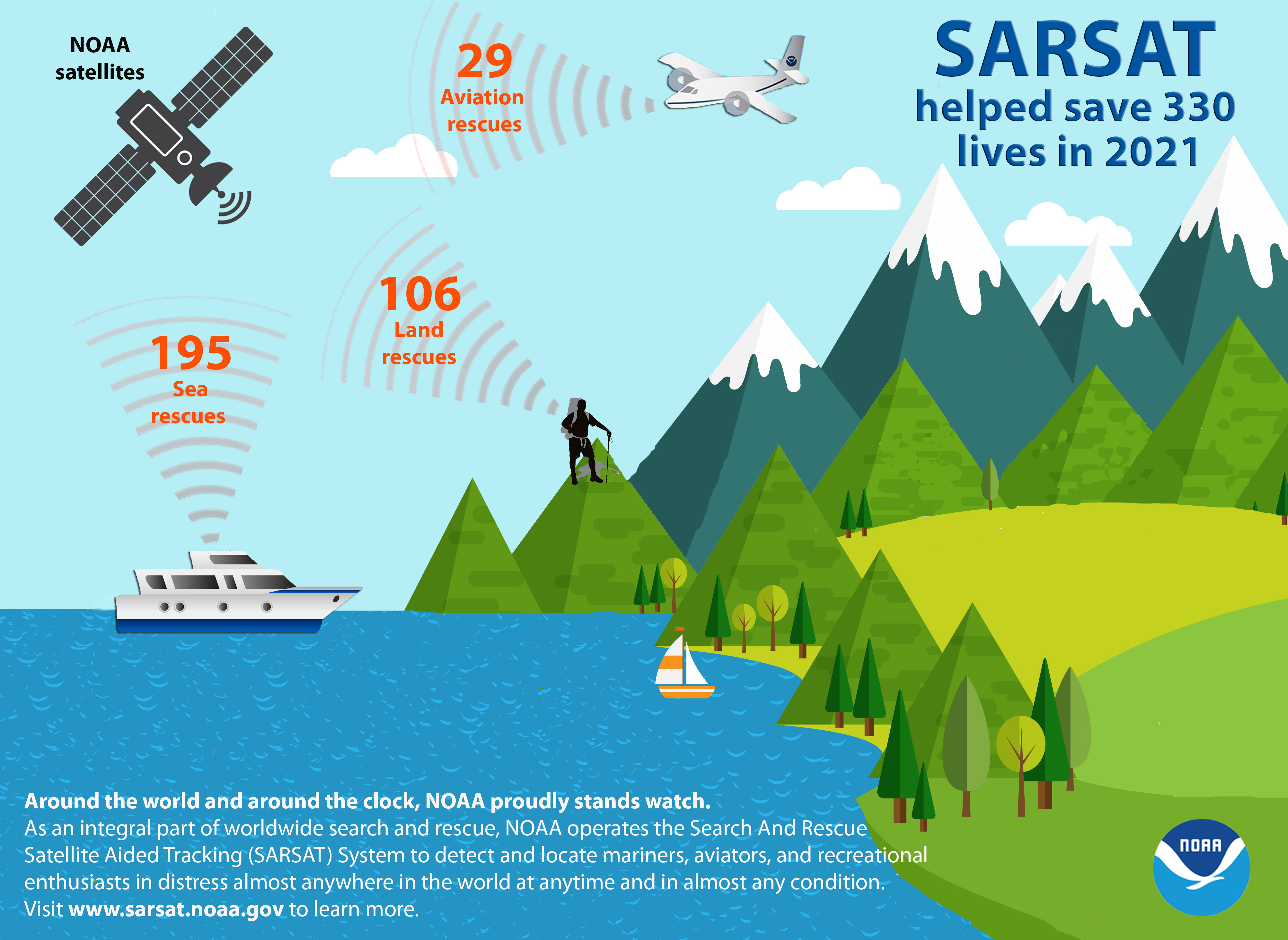 Around the world...around the clock...NOAA proudly stands watch. As an integral part of worldwide search and rescue, NOAA operates the Search And Rescue
Satellite Aided Tracking (SARSAT) System to detect and locate mariners, aviators, and recreational enthusiasts in distress almost anywhere in the world
at anytime and in almost any condition.
Around the world...around the clock...NOAA proudly stands watch. As an integral part of worldwide search and rescue, NOAA operates the Search And Rescue
Satellite Aided Tracking (SARSAT) System to detect and locate mariners, aviators, and recreational enthusiasts in distress almost anywhere in the world
at anytime and in almost any condition.
The SARSAT system uses NOAA satellites in low-earth and geostationary orbits as well as GPS satellites in medium earth orbit to detect and locate
aviators, mariners, and land-based users in distress. The satellites relay distress signals from emergency beacons to a network of ground stations and
ultimately to the U.S. Mission Control Center (USMCC) in Suitland, Maryland. The USMCC processes the distress signal and alerts the appropriate search
and rescue authorities to who is in distress and, more importantly, where they are located. Truly, SARSAT takes the "search" out of search and rescue!
NOAA-SARSAT is a part of the international Cospas-Sarsat Program to which 41 nations and two independent SAR organizations belong.
For more information on NOAA SARSAT you can follow the link provided below. This NOAA SARSAT page contains Information on Beacon registration, system
overview, national weekly and annual distress events and much more for both beacon owners and the general public.
We highly encourage everyone to visit us at: https://www.sarsat.noaa.gov/ and for more information on the international system to visit the
COSPAS-SARSAT Programme at https://www.cospas-sarsat.int/en/.
SARSAT - A lifeline to survival.